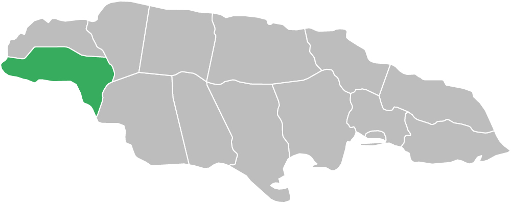
Westmoreland Parish, Jamaica is located on the south-western side of Jamaica in the county of Cornwall. Known for its beaches, tourism, fertile plains, historic towns, sugar estate history, wetlands, and rural communities, Westmoreland is one of the most distinctive parishes in western Jamaica.
Westmoreland is bordered by Hanover to the north, Saint Elizabeth and Saint James to the east, and the Caribbean Sea to the south. As one of the 14 parishes of Jamaica, Westmoreland also forms part of the wider Caribbean region.
The parish includes a varied natural landscape of white limestone, marl, sand, gravel, coral reefs, plains, wetlands, and river systems. Lying partly on the Georges Plain, Westmoreland is drained by the Cabaritta River and is also known for important natural areas such as the Great Morass.
The parish is administered by the Westmoreland Municipal Corporation, which oversees local governance, infrastructure, and development.
Land Area: 785.2 sq km (303.2 sq mi)
Capital Town: Savanna-la-Mar
Westmoreland Parish, Jamaica was established in 1703 after the English took control of the island from Spanish rule. The parish is believed to have received its name because it marked the westernmost section of the island at the time. One of the earliest Spanish settlements in the area was at present-day Bluefields, while the capital, Savanna-la-Mar, developed as an export port from around 1730.
Savanna-la-Mar became important as a sugar port, and the parish later developed into one of Jamaica’s key agricultural areas because of its fertile soils and relatively low relief. The town of Frome, located inland from the capital, became especially important as one of the country’s remaining sugar-producing areas.
Westmoreland also holds an important place in Jamaican political history. In 1938, labour unrest at the Frome sugar estate helped change the course of Jamaican history. The events of 1938 contributed to the reforms that led to universal adult suffrage in 1944 and helped place Jamaica on the path toward self-government and eventual independence.
The parish is also shaped by its natural history. Wetland areas such as the Great Morass have long served as wildlife habitats and important ecological zones, while rivers and streams continue to support agriculture and settlement across Westmoreland.
The geography of Westmoreland Parish, Jamaica includes plains, wetlands, rivers, beaches, coral reef areas, and inland hills. The parish has a mix of coastal tourism districts, fertile agricultural lands, and rural mountain-edge communities, giving it one of the most varied landscapes in western Jamaica.
Westmoreland lies partly on the Georges Plain and is drained by the Cabaritta River, one of the parish’s most important waterways. The Great Morass, one of Jamaica’s major wetland systems, is also located in the parish and supports plant and animal life while adding to Westmoreland’s environmental importance.
Coastal communities such as Negril, Bluefields, and Whitehouse contrast with inland districts such as Bethel Town, Grange Hill, Seaford Town, and Petersfield.
The economy of Westmoreland Parish, Jamaica is based on tourism, agriculture, fishing, commerce, and local services. The parish contains one of Jamaica’s most internationally recognized resort areas in Negril, which plays a major role in tourism, hospitality, and transportation in western Jamaica.
Agriculture remains important across the parish, supported by fertile soils and access to water. Communities such as Frome, Bethel Town, Grange Hill, and Petersfield contribute to farming and local trade, while fishing and marine activity remain important in coastal districts.
Commercial and administrative activity is centered around Savanna-la-Mar, the parish capital, while resort and villa development continue to support the economy in areas such as Negril and nearby coastal communities.
The major towns and places in Westmoreland Parish serve as important centers for tourism, commerce, agriculture, fishing, transport, and local life across the parish.
Westmoreland is one of Jamaica’s strongest tourism parishes because it combines world-famous resort areas, beaches, wetlands, and rural scenery. Negril is the parish’s strongest tourism brand, while coastal communities such as Bluefields and Whitehouse also contribute to the visitor economy.
The parish’s natural environment, including the Great Morass, coral reef areas, and river systems, also adds ecological value and supports fishing, recreation, and local heritage. Westmoreland’s location further connects it to tourism flows from Hanover, Saint James, and Saint Elizabeth.
This section includes towns, villages, districts, and local communities across Westmoreland Parish. These places form the backbone of the parish’s population, tourism, agriculture, commerce, and local culture.
Westmoreland is one of the 14 parishes of Jamaica and is part of the wider Caribbean. Its combination of tourism, wetlands, agriculture, beaches, history, and coastal and inland communities makes it one of the most important parishes in western Jamaica.
Westmoreland is located on the south-western side of Jamaica, bordered by Hanover, Saint Elizabeth, Saint James, and the Caribbean Sea.
Westmoreland is known for Negril, Savanna-la-Mar, the Great Morass, sugar estate history in Frome, beaches, fishing communities, and tourism in western Jamaica.
The capital town of Westmoreland Parish is Savanna-la-Mar.
