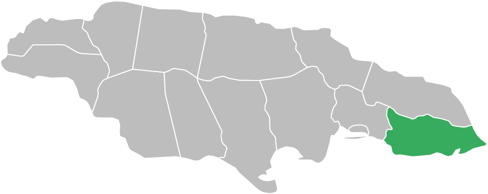
Saint Thomas Parish, Jamaica is located at the south-eastern tip of Jamaica in the county of Surrey. Known for its mountains, valleys, rivers, coastal plains, historic sites, and strong cultural heritage, Saint Thomas is one of the most scenic and historically important parishes on the island.
Saint Thomas is bordered by Saint Andrew to the west, Portland to the north, and the Caribbean Sea to the south and east. As one of the 14 parishes of Jamaica, Saint Thomas also forms part of the wider Caribbean region.
The land mass of Saint Thomas stretches from the peaks and ridges of the Blue Mountains and John Crow Mountains down to sea level. The Port Royal Mountain Range rises to approximately 1,219.2 metres (4,000 feet) in some sections and runs from above Newcastle in Saint Andrew toward the coast in areas of Saint Thomas such as Albion.
The parish is administered by the St. Thomas Municipal Corporation, which oversees local governance, infrastructure, and development.
Land Area: 742.2 sq km (286.5 sq mi)
Capital Town: Morant Bay
Long before modern Jamaicans inhabited the parish, other peoples moved among the forests and grasslands of Saint Thomas. Human settlement in the parish stretches back as far as 650 AD, when the Taíno people reached the island. Archaeologists have identified Taíno settlements at places such as Spanish Wood, Retreat, Belvedere, Cambridge Hill, and Yallahs.
Evidence of the parish’s early economic role can be seen in its settlement pattern. The first Spanish settlers in Saint Thomas established cattle ranches at “Morante,” later called Morant Bay, and at Ayala, now Yallahs.
In later years, bands of Maroons settled in the Saint Thomas Mountains and joined with those in Portland, becoming part of the Windward Maroons. The history of Saint Thomas is now most strongly associated with the events of 1865, which led to Jamaica’s Assembly being dissolved and the island’s status changing to that of a Crown Colony.
These events also made Paul Bogle and George William Gordon National Heroes and turned Stony Gut and Morant Bay into places of national historical importance.
The geography of Saint Thomas Parish, Jamaica includes mountain ridges, river valleys, coastal communities, plains, and rural farming districts. The parish descends from the high elevations of the Blue Mountains and John Crow Mountains to the Caribbean Sea.
Saint Thomas includes mountain and upland communities such as Hagley Gap, Heart Ease, and Trinity Ville, as well as coastal and lowland communities such as Morant Bay, Port Morant, Yallahs, and White Horses.
The economy of Saint Thomas Parish, Jamaica is based on agriculture, fishing, commerce, and local services. Farming remains important across the parish, while coastal communities support fishing and small-scale trade.
Commercial and community activity is centered around towns such as Morant Bay, Yallahs, Seaforth, Bath, and Port Morant. Tourism and heritage also contribute through attractions, natural scenery, and important historic sites.
The major towns and places in Saint Thomas Parish serve as important centers for history, commerce, transport, agriculture, and local life across the parish.
Saint Thomas is home to natural and heritage attractions that reflect the parish’s scenic landscape and historical importance.
Saint Thomas contains several important monuments and historic sites linked to national memory and the Morant Bay Rebellion.
This section includes towns, villages, districts, and local communities across Saint Thomas Parish. These places form the backbone of the parish’s population, agriculture, heritage, and local economy.
Saint Thomas is one of the 14 parishes of Jamaica and is part of the wider Caribbean region. Its combination of mountains, coastlines, agriculture, rebellion history, and cultural significance makes it one of the most distinctive parishes on the island.
Saint Thomas is located at the south-eastern tip of Jamaica, bordered by Saint Andrew, Portland, and the Caribbean Sea.
Saint Thomas is known for Morant Bay, the Morant Bay Rebellion, Bath, Yallahs, mountain scenery, and historic sites such as Stony Gut.
The capital town of Saint Thomas Parish is Morant Bay.
