Saint Mary Parish, Jamaica is a parish located in the north-eastern section of Jamaica within the county of Surrey. Known for its mountains, rivers, banana-growing districts, historic towns, and beautiful coastal communities, Saint Mary plays an important role in Jamaica’s history, agriculture, and tourism.
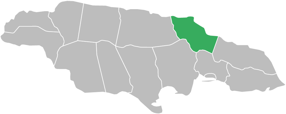
Saint Mary is bordered by Portland to the east, Saint Ann to the west, parts of Saint Catherine and Saint Andrew to the south, and the Caribbean Sea to the north. As one of the 14 parishes of Jamaica, Saint Mary also forms part of the wider Caribbean region.
Saint Mary is mostly mountainous, reaching nearly 4,000 feet at its highest points. The parish is also shaped by three major rivers: the Rio Nuevo River, Wag Water River, and White River, which help define its valleys, wetlands, and agricultural lands.
The parish is administered by the St. Mary Municipal Corporation, which oversees local governance, infrastructure, and development.
Land Area: 611.3 sq km (236.0 sq mi)
Capital Town: Port Maria
Saint Mary is well known for being one of the first sections of Jamaica to be occupied by the Spaniards. After the English captured Jamaica from Spain in 1655, the area around the town of Puerto Santa Maria became known as Saint Mary. Port Maria, the current capital of the parish, was the second town built by the Spaniards on the island.
Today, the parish includes the former parish of Metcalfe and part of the former parish of Saint George. Saint Mary contains numerous historic and national sites, including Nonsuch and the wider Rio Nuevo area, which is historically significant as the site of the last major battle between the invading English and the defending Spaniards before the Spanish fled to Cuba.
In 1760, one of the most serious rebellions in Jamaica’s history broke out around Port Maria and spread across much of the island. The rebellion was led by Tacky, a Coromantee slave associated with the Frontier Estate. After emancipation, free villages developed in Saint Mary, although large estates continued to dominate much of the parish.
With the decline of sugar in the 19th century, banana cultivation became more important. In the late 1930s, Saint Mary played a prominent role in the creation of the Jamaica Producers Association, which helped Jamaican banana growers work together against foreign monopoly control in the banana trade.
The geography of Saint Mary Parish, Jamaica includes mountains, river valleys, coastal plains, wetlands, beaches, and farming districts. Much of the parish is hilly or mountainous, while the northern coastline supports fishing communities, small towns, and tourism-related activity.
Saint Mary includes major communities such as Port Maria, Annotto Bay, Oracabessa, and Highgate. Rivers such as the Wag Water, Rio Nuevo, and White River help shape the parish’s valleys and agricultural zones.
The economy of Saint Mary Parish, Jamaica is based on agriculture, fishing, commerce, and tourism. The parish has long been associated with banana cultivation and remains important to Jamaica’s agricultural sector.
Commercial and community activity is centered around towns such as Port Maria, Annotto Bay, Highgate, and Oracabessa. Tourism also contributes to the local economy, especially along the coast and in communities known for scenery, beaches, and heritage.
The major towns and places in Saint Mary Parish serve as important centers for commerce, agriculture, transport, tourism, and local life across the parish.
Saint Mary combines strong historical value with coastal and rural tourism appeal. Areas such as Oracabessa, Boscobel, and Port Maria help give the parish a distinct identity within north-eastern Jamaica.
The parish also connects naturally with nearby destinations in Portland and Saint Ann, making Saint Mary an important link between Jamaica’s eastern and north-coastal regions.
This section includes towns, villages, districts, and local communities across Saint Mary Parish. These places form the backbone of the parish’s population, agriculture, commerce, and local economy.
Saint Mary is one of the 14 parishes of Jamaica and is part of the wider Caribbean region. Its combination of rivers, mountains, coastal settlements, agriculture, and historical importance makes it one of the most distinctive parishes in north-eastern Jamaica.
Saint Mary is located in the north-eastern section of Jamaica, bordered by Portland, Saint Ann, parts of Saint Catherine, Saint Andrew, and the Caribbean Sea.
Saint Mary is known for Port Maria, Oracabessa, banana cultivation, rivers, mountains, and its early Spanish and colonial history.
The capital town of Saint Mary Parish is Port Maria.
